As usual, I forgot my camera (what a surprise, huh?) so all I had was my iPhone.
I took the Friday before Red Hot off work, and left Denver Thursday night with my son.
We'd been planning to explore this youngest-in-Colorado volcanic crater for months. Many of you know I majored in geology at Kansas University (in a previous life). From Google Earth, it's starkly obvious that in addition to the main crater, there's a big crack that heads north-east to a much smaller crater. I wanted to check it all out.
If you're not a geology geek, this post might seem boring - just warning you.

We arrived about 10pm on a moonless night, so exploring had to wait until the next morning.
We slept in a tent and it got down to 10F.
In the morning, I found huge canine footprints. I suppose they could be dog. There were no human prints around, and they were the biggest canine prints I've ever seen. My brother, John, and I found a dead wolf several years ago with a tracking collar still on, right next to I-70, so I know wolves are back in northern Colorado. No telling for certain what it was, but it was might huge. I could easily see them belonging to a creature that weighed as much as my 175lbs.
The Dotsero feature blew around 4200 years ago, so about 2200B.C, in the time of the Pharoahs in Egypt. It was a steam-powered explosion like a mini version of Mt. Saint Helens. Lots of pyroclast covers the terrain in the region, but it looks more like cinders and mixed-up steamy mud than lava. I-70 actually runs right over a solidified pyroclastic flow.
We checked out the little crater first.

As you can see from the sky the crater is obvious. But from the ground, it was a dud. In fact, it was hard to believe we were actually standing on the feature.

The slope behind the crater in the image above is not part of the crater, but the slight slope to the right is. My son is standing in the 20ft crater. Only scruffy grass grows there - I'm guessing because of the pH of the soil or something like that being wrong, none of the sage that grew thick everywhere else was growing in the crater.
Below is the little crater rim, with a big cinder rock.

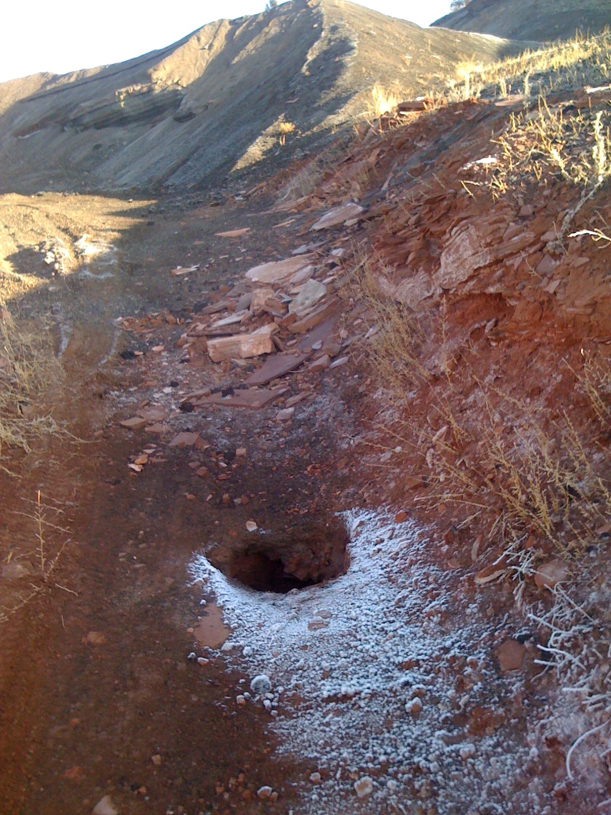
In this post's 2nd photo above, both the crater and the ditch are circled. The image below was taken where the bottom red circle is.

The whole area is eroded with smooth, shallow ravines and nearly all features are rounded. This ravine is the fissure, and the red dirt it cuts through is so soft you can crumble it easily with your fingers. Yet as soft as it is, the edges of the fissure are sharp and jagged in stark contrast to the surrounding features.
To me, this is a bit of a puzzle. A fault-line usually moves. So either the craters should have been sliced in their middles and mismatched, or one side of the fissure should be higher than the other. Neither was true. This fissure hasn't slid anywhere in 4200 years. But it must be active or the ravine wouldn't have sharp features. Dirt must still be moving upwards, cracking in the middle, even as it erodes away. That's the only way I see that this ravine can stay looking so young.
The big crater was much more impressive.

The northeast end was very DeathValley-ish. In fact, I wondered if the big cinder hill to the east of the crater was still rising up? I stood there looking up at it trying to see some sign of activity, and also taking in the morning sun finally warming things up. That's when I noticed the steam. Up on the hill east of the big crater, amongst the crisscrossing roads of the cinder quarry, was a steaming hole in the ground.
The parting shot is of part of the mud-flow. Glenwood Canyon has lots layers of red sedimentary rocks. Here you can see the same rocks jumbled up with mud.

The area where we camped is going to be where I will probably stop many times in the future. It's just out in the middle of nowhere, just far enough away from I-70 not to hear or smell the traffic.
BLM land used to be free, no rules, no restrictions. These days, there's no discernible difference between BLM and National Forest or even National Parks, sometimes. Nearly all my favorite free camping locations now charge fees. I saw a BLM sign explaining this was so they could afford to "improve" things. Well, sorry, if you want things "improved" on BLM land, then change the designation to "NFS" or "...Parks". Don't ever "improve" my BLM land, and don't charge me for it. Every time they build restrooms, it draws more of the wrong kinds of people - the kind who don't want to rough-it. That kind is more likely to bring trash and leave it, to inflict unreasonable destruction to the landscape.
Below is how someone felt about this trend at Fruita...

Shot it full of holes and knocked it down with a 4x4.
I don't condone vandalism, especially if guns are involved. As far as I'm concerned, if someone uses guns to inflict vandalism on property, they should be banned for life from owning firearms, the same way felons are.
Very cool! Olga just laughs at me when I get excited each time we go to the Austin airport. There is a Cretaceous period volcano just west of the airport. Nothing more than a flat knob now and 99.9% of the people in Austin don't even realize it's there. Unfortunately, it's on private land and you can only access the margins where the trap rock is located.
ReplyDeletep.s. Vandals suck!!!
Oh, yes! They put a water tank on top of it! You can barely make out the edges of lava flows on Google Earth.
ReplyDeleteAustin is a really interesting area. My favorite parts of Texas are in the triangle of Austin, San Antonio, Junction. Wish I could do Bandera 100K ever year.